Cornerstone guide
The honest guide to moving to Pagosa Springs
Climate, work, schools, medical care, and the gap between the town you visit and the county you actually live in.
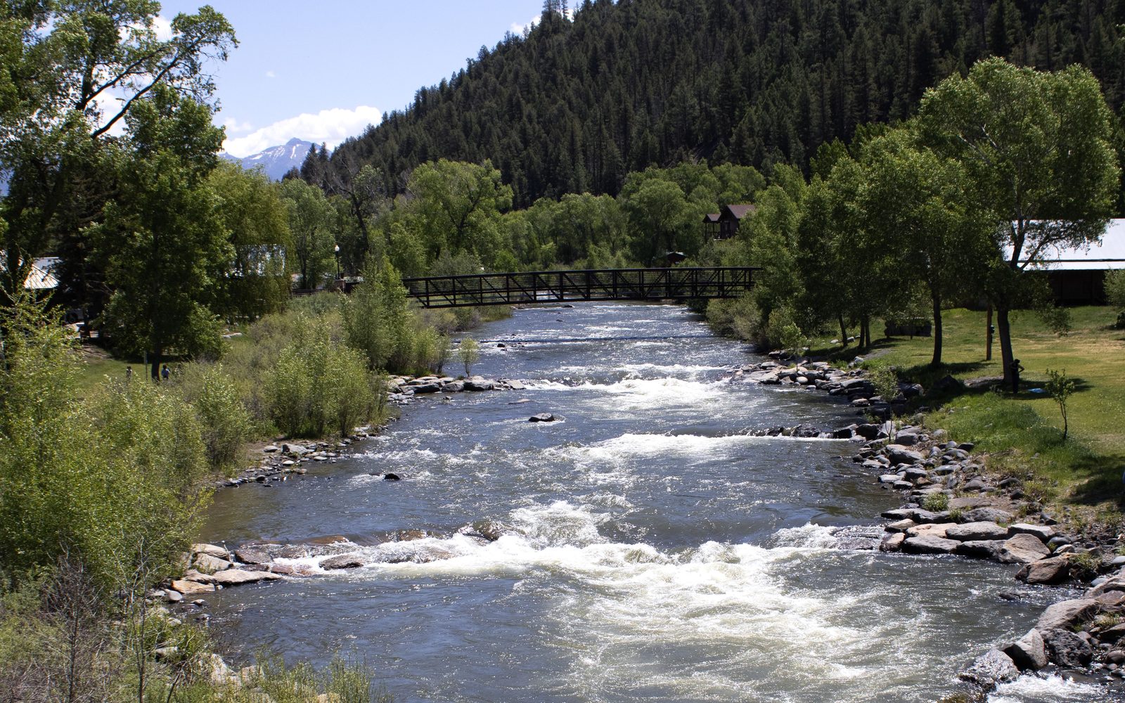
People who have spent one good weekend here ask the same question: Could we live this? The honest answer is yes — and also that the weekend is a liar. July on the riverwalk is not January on a county road. A soak in town is not a school-year calendar. If you came from a larger city, Pagosa can feel like you finally found the volume knob. It will also feel small, high, and farther from a Target than your brain wants to admit.
Whether it is worth it depends on why you are coming.
The place, not the postcard
Pagosa Springs is a home-rule town and the county seat of Archuleta County. It is the only incorporated municipality in the county. The 2020 Census counted 1,571 people in town. The county as a whole had 13,359 people in 2020, on about 1,350 square miles of land. Most of the people who say they live “in Pagosa” live in unincorporated Archuleta County.
That is the first thing to get in your head. Town ordinances, town vacation-rental rules, and town streets stop at the town boundary. A few miles west you are in a different stack of special districts, covenants, and road responsibilities. If you skip neighborhoods and wells, septic, and roads, you will buy the wrong kind of house for the life you think you’re moving to.
The town sits on the San Juan River at roughly 7,110 to 7,126 feet, depending on whether you use the USGS GNIS elevation or the figure used in local writeups. Either way: you are high. People who “don’t get altitude” in Breckenridge can still feel it the first week here, especially if they try to hike like they did at 500 feet. Drink water. Slow down. The pride of arriving and immediately splitting wood is how you spend day two on the couch.
The name comes from the sulfur springs. Local accounts differ on the Ute translation — you’ll hear “healing waters” and you’ll hear a blunter version about water that smells. The Mother Spring is famous enough that Colorado has claimed a deepest-geothermal-hot-spring record. You can look at it from the river. You should not treat the primitive springs like a municipal pool. They are extremely hot.
Climate: four seasons, and they mean it
Local tourism copy calls this the “Colorado Sunbelt” and cites about 300 days of sun. Summers are the reason people stay. Visit Pagosa Springs puts July around an 80°F daytime high and 45°F at night. January is the other bookend: roughly a 39°F high and a 4°F low on that same page. Wikipedia’s 2000–2015 normals for the town are in the same neighborhood — January mean high 37.9°F, mean low 1.4°F, and about 20.22 inches of precipitation over the year.
Snow is where sources disagree, and this guide will not pick a pretty number and hope. Visit Pagosa Springs says 67.4 inches of snow a year downtown. A Wikipedia climate table for 2000–2015 shows 101.5 inches. A local community page says downtown snow is about 60 inches. Explore Pagosa has used 107 inches. Different stations, different periods, different “downtowns.” What locals will tell you is simpler: the valley is not Wolf Creek, and Wolf Creek is not the valley.
Wolf Creek Ski Area, 23 miles up U.S. 160, publishes 430 inches of average annual snowfall, a 10,300-foot base, and an 11,904-foot summit. That is a different climate. You can have a dry street in town and a pass that needs a real winter driver. You can also have a March storm that dumps in the pines west of town and barely shows on Hot Springs Boulevard. If you need one sentence: plan for a real winter at home and a serious winter if your life includes the pass.
The other climate fact people underweight is the swing. Bright sun, thin air, and a 40-degree drop after dinner are normal. Gardens are short. Shade is precious in July and useless in January. If you are moving from a humid lowland city, laundry dries faster than you expect and a parked car stays cold longer than you expect.
How far away everything is
This is not a suburb of anywhere.
Explore Pagosa’s mileage list, the one people use when they ask “how far is…”, is:
| From Pagosa | Driving miles (Explore Pagosa) |
|---|---|
| Durango | 61 |
| Durango-La Plata County Airport (DRO) | 60 |
| Farmington, N.M. | 101 |
| Albuquerque | 212 |
| Santa Fe | 160 |
| Denver | 277 |
| Colorado Springs | 242 |
| Dallas | 813 |
Treat about an hour to Durango as the practical figure, and do not pretend it is a Tuesday errand every week. Wikipedia’s “47 miles east of Durango” is a useful reminder that published distances and winter driving are not the same thing.
Wolf Creek is 23 miles. South Fork is on the other side of the pass. Albuquerque is the big-airport option when DRO’s schedule or weather doesn’t work. Stevens Field (KPSO) is about 3 miles west of downtown — a general-aviation airport with an 8,100-foot runway. Useful if you fly yourself. Not a commercial alternative.
Dallas to Pagosa is a long day. Split-time life between Texas and the San Juans is doable. It is not casual. If your plan depends on popping back whenever you feel like it, check DRO connections before you sell a house in a bigger city.
Work, money, and the size of the pond
Archuleta County’s 2020 Census profile is not a boomtown story. Median age in the county was 52.2. About 28.3% of residents were 65 or older. There were 9,495 housing units and 5,792 households — and 39.0% of those housing units were vacant. Read that again if you are coming to “join a growing scene.” A lot of the houses you will drive past are empty on a Tuesday in November.
The 2017 Archuleta County Community Plan (still the county’s adopted community-plan document people point to) is blunt about the economy: employment earnings are only part of local income. Dividends, interest, rent, and transfer payments matter. Self-employment is common. The old timber economy is not coming back as a mass employer. Tourism, construction, health care, schools, trades, and remote work are the mix on the ground.
If you need a deep labor market, this is the wrong county. If you can bring a living with you — retirement, remote work, a trade, a business you already understand — you can make it. Housing for people who work here is a real civic argument, which is one reason the town has been strict about short-term rentals. That is covered in the second-home guide.
Internet is not one story. Some addresses have a decent wired connection. Plenty of acreage still depends on fixed wireless or satellite. This guide will not name a provider as “the Pagosa internet” because coverage is address-specific and marketing maps lie. Check the exact house. Then check it again in a storm.
Schools
Public schools are Archuleta School District 50-JT. The district office is at 309 Lewis Street. Pagosa Springs High School is the comprehensive high school. There is also Pagosa Peak Open School, a public charter, and other alternatives people use. Families who choose the high school often talk about size: smaller, outdoor, the kind of place where a kid can play more than one sport and still be known.
That is the upside. The downside of a small district is the same as the upside: fewer courses, longer bus rides from the far subdivisions, and a community that notices everything. If you need a 3,000-student suburban menu of electives, you will feel the ceiling. If you want your kid’s teacher to know your name at City Market, you will feel the floor.
The county is also overlapped, on the edges, by other districts (Bayfield and Ignacio appear on the Census school-district map). If you buy toward the west or southwest, confirm which district the parcel is actually in. Do not assume “Pagosa schools” from a Pagosa mailing address.
Medical care
Pagosa Springs Medical Center is a critical access hospital at 95 S. Pagosa Boulevard. Emergency department is 24/7. Primary care is weekday hours, not a 24-hour urban clinic. For a rural county this is a serious asset. It is also not Denver.
If you have a complicated specialist, you will travel — Durango, Farmington, Albuquerque, or the Front Range. That is not a reason to stay away. It is a reason to be honest about aging parents, high-risk pregnancy, or a condition that needs a particular team. Some households can live with that trade. Not everyone can.
Daily life: what you will miss, and what you won’t
You will miss easy international food, late-night anything, and the feeling that a store has every part. You will not miss sitting in big-city traffic to get to a trailhead that still isn’t wilderness.
Groceries and basic hardware exist. The specific-part run is Durango or a delivery box that takes its time. People make a day of it. In winter, people stack those days on the weather window. If your personality requires same-day consumer culture, you will be irritated here, and you will take it out on the town, and the town will not care.
Community is real and it is not automatic. Church, school sports, volunteer boards, and the same café — that’s how you get known. If you want anonymity, buy farther out and accept a longer drive for ice melt.
Flood, fire, and the river you came for
The San Juan is the reason downtown exists. It is also a river. In October 2025 the river came up hard after heavy rain. Bridges were damaged, a sewer line failed, soaking pools at The Springs Resort took on muddy water, a stretch of U.S. 160 closed, and people on Hermosa Street, San Juan Street, and east of Hot Springs Boulevard were evacuated. The town used the Ross Aragon Community Center as an emergency site. That is not here to scare you. It is here because “mountain town” includes water that does not stay in the channel.
Wildfire is the other half of that sentence. You live in a forested county with a lot of public land. Defensible space, insurance, and access roads are not aesthetic choices. More on insurance in the cost guide.
Is it worth it?
It is worth it for people who want a town they can know, snow within reach, and a small school more than they want a deep job market. It is not worth it if you need a specialist on retainer, or a house that “just works” like a subdivision in a Texas suburb.
If you are moving for the hot springs and the Instagram autumn, rent a winter first. January will tell you faster than a guide can. If you are moving because you already know how you make a living and you want the mountains to be the background of an ordinary life, you can build that here. Start with the unsexy guides. The pretty ones will still be pretty when you’re done.
Next: Wells, septic, propane, and mountain roads. Then neighborhoods. If the house you want is a cabin you visit, read second homes before you tell yourself it will pay for itself.
Sources
- U.S. Census / Wikipedia compilation for Pagosa Springs (town): home-rule municipality, county seat, only incorporated municipality in Archuleta County; 2020 population 1,571; elevation 7,110 ft (GNIS) and 7,126 ft in body text; 47 miles east of Durango; ~35 miles north of the New Mexico border; ZIP 81147/81157; climate table 2000–2015. https://en.wikipedia.org/wiki/Pagosa_Springs,_Colorado
- U.S. Census / Wikipedia compilation for Archuleta County: founded April 14, 1885; 1,356 sq mi total / 1,350 sq mi land; 2020 population 13,359; 5,792 households; 9,495 housing units; 39.0% vacant; median age 52.2; 28.3% age 65+; school districts include 50-JT, Bayfield 10 JT-R, Ignacio 11-JT. https://en.wikipedia.org/wiki/Archuleta_County,_Colorado
- Visit Pagosa Springs, weather page: ~300 days of sun; 20.64 inches precipitation; 67.4 inches snow downtown; 400+ inches on Wolf Creek Pass; monthly temperatures. https://visitpagosasprings.com/the-weathers-fine
- Explore Pagosa, “Getting Here From There”: Stevens Field ~3 miles west, 8,100-ft runway, identifier KPSO; DRO ~60 miles; mileage table (Durango 61, Denver 277, Albuquerque 212, Farmington 101, Dallas 813). https://www.explorepagosa.com/getting-here-from-there/
- Wolf Creek Ski Area, “The Mountain”: 23 miles from Pagosa Springs; 430 in average snowfall; base 10,300 ft; summit 11,904 ft. https://wolfcreekski.com/the-mountain/
- Pagosa Springs Medical Center: critical access hospital; 95 S. Pagosa Blvd.; ED 24/7. https://www.pagosaspringsmedicalcenter.org/
- Archuleta School District 50-JT: 309 Lewis Street, Pagosa Springs; (970) 264-2228. https://www.mypagosaschools.com/
- Pagosa Peak Open School community page: county-wide population described as about 14,000, most outside town; ~34% private land / ~66% Forest Service and Southern Ute (local page; treat as community context, not a Census table). https://pagosapeakopenschool.org/about-our-community/
- CBS News, Oct. 12, 2025, and Denver9, Oct. 14, 2025, as cited in the Pagosa Springs Wikipedia “2025 flood” section: evacuations, Highway 160, sewer-line failure, 7,200 cfs cited in town messaging. https://en.wikipedia.org/wiki/Pagosa_Springs,_Colorado
- Archuleta County Community Plan (2017 PDF, circulated locally): Navajo State Park / Arboles; employment and income structure. https://pagosadailypost.com/wp-content/uploads/2025/05/2017-Arch-County-Community-Plan.pdf
- Explore Pagosa FAQ: altitude caution at 7,000+ feet. https://www.explorepagosa.com/frequently-asked-questions/